The Haverstraw riverfront did not always look like a place people go on purpose. For most of the twentieth century, the Village of Haverstraw's Hudson shoreline was a working edge — brickyards, warehouses, and lots that turned their backs on the water. Today the village treats the riverfront as its front door, and the shift happened through decades of planning decisions, cleanup grants, and residential construction rather than one single project.
The short answer: Haverstraw rebuilt its waterfront by rezoning former industrial land for housing and public access, cleaning up legacy sites, extending the street grid toward the river, and tying the whole effort to events and parks that draw residents back to the shoreline. Here is how that unfolded, based on milestones the village and Rockland County have documented.
Why was the waterfront industrial in the first place?
Haverstraw village spent more than a century as one of the Hudson Valley's brickmaking centers. Clay banks along the shore fed dozens of brickyards, and Haverstraw bricks helped build much of New York City. That industry put docks, kilns, and rail spurs directly on the water, which made sense for shipping but left the river difficult for residents to reach.
When the brick industry collapsed in the early twentieth century, the village inherited a shoreline full of vacant industrial parcels. Some carried soil contamination typical of old manufacturing sites. The river was close to nearly every house in the village but, in practical terms, hard to get to.
When did the village start planning for redevelopment?
Local officials began treating the waterfront as a redevelopment priority in the late twentieth century, as river towns across the Hudson Valley reassessed their shorelines. The Village of Haverstraw adopted waterfront revitalization planning consistent with New York State's coastal and waterfront programs, which opened the door to state grants and technical help.
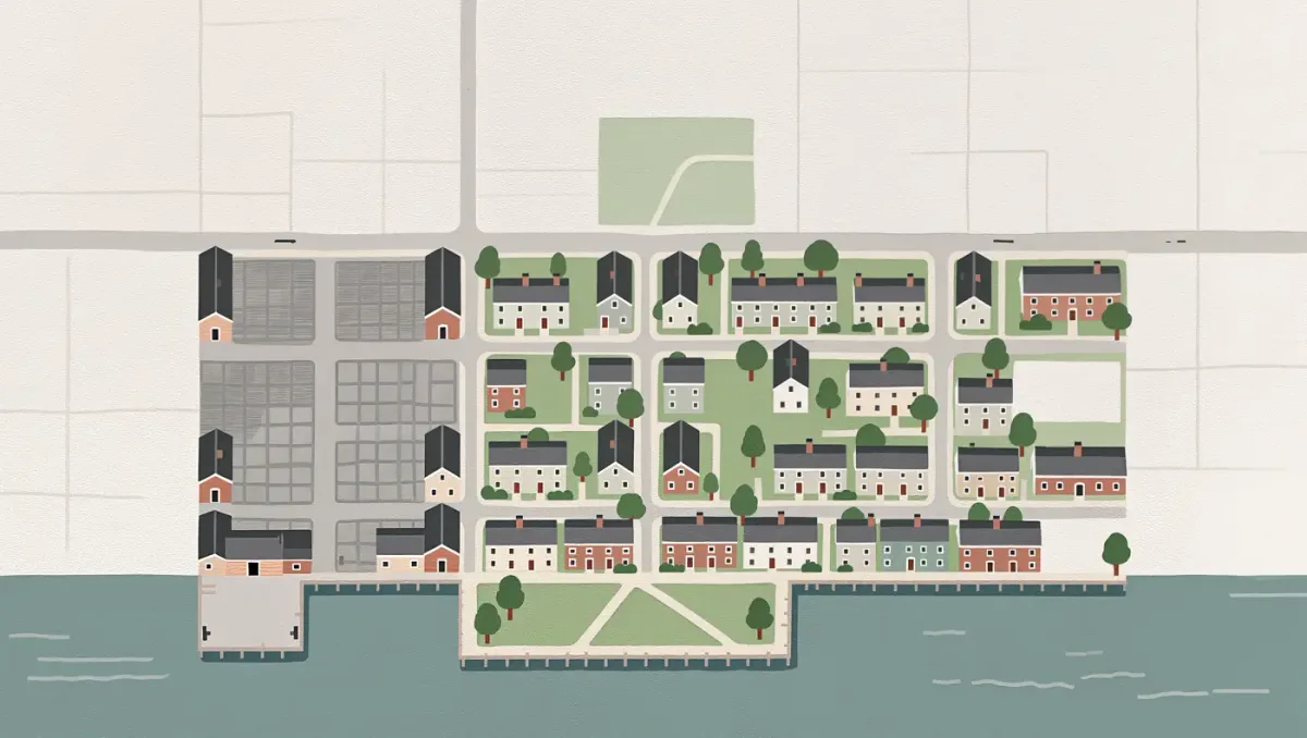
The planning work established principles that still shape the area: keep the river visible from the street grid, add public access points, and replace vacant industrial land with housing that puts residents near downtown. Those documents mattered because later developers and grant agencies could point to an adopted plan instead of starting from zero.
What did the revitalization plans aim to protect?
The plans went beyond construction. They called for keeping public views of the Hudson, maintaining access points such as the village's parks and boat landing, and respecting the historic street grid that dates to the village's brickmaking era. Haverstraw's downtown row of nineteenth-century commercial buildings became part of the argument for redevelopment: a waterfront worth visiting needs a downtown worth walking through.
Historic preservation and redevelopment have not always moved in step. Residents have periodically pressed village boards to protect older structures while new buildings rise nearby. The tension is a standing feature of every waterfront project review, not a problem the plans solved once and for all.
What actually got built along the river?
The most visible change has been residential. Builders converted former industrial and commercial parcels into apartment and condominium complexes in the 2000s and 2010s, adding market-rate and mixed-income housing within walking distance of the village's Main Street shops. The buildings were designed to face the water, reversing the old pattern of backs turned to the Hudson.
Public space advanced alongside the housing. Emeline Park, long the village's main riverfront open space, served as the anchor, and the village used it for concerts and the annual Haverstraw RiverWide festival. Sidewalk and streetscape improvements aimed to connect downtown businesses to the shoreline so a walk to the river passes shops rather than vacant lots.
Did cleanup projects play a role?
Yes. Former brickyard and industrial sites along the shore required environmental assessment before they could be reused, and several parcels moved forward through state brownfield programs. New York's cleanup and redevelopment frameworks let a developer investigate contamination, agree on a remedy with the state, and then build — a path the village leaned on for its larger waterfront parcels.
For residents, the practical effect was gradual: fenced-off lots became construction sites, and construction sites became occupied buildings with public paths along the water's edge.
What about the ferry landing?
The village also restored a transportation link that the brick era had taken for granted. A commuter ferry connecting Haverstraw with Ossining across the river operates from a village landing, letting Rockland riders reach Metro-North's Hudson Line without driving. The service has started and paused over the years with funding cycles, but the landing itself became another reason the riverfront functions as public infrastructure rather than a backdrop.
How did residents shape the process?
Public hearings and waterfront committees gave villagers a formal voice at each stage, and community groups helped organize programming that made the shoreline a destination. Annual events, fishing access, and volunteer cleanups built a constituency for the riverfront that outlasted any single administration. That constituency matters: projects funded through grants typically need documented public support, and Haverstraw's residents supplied it at meeting after meeting over the years.
How is the riverfront managed today?
The Village of Haverstraw governs the shoreline through its zoning code, planning and zoning boards, and special revitalization efforts, with support from Rockland County and New York State programs. Events such as RiverWide and the village's growing Latino commercial corridor downtown feed foot traffic between Main Street and the water.
Redevelopment has brought debates familiar to any river town — parking, building height, rents, and who benefits from new construction. Those conversations happen at village board meetings, which remain the place where the next phase of the riverfront will be decided.
What lessons does Haverstraw offer other river towns?
Nyack and other Hudson shoreline communities in Rockland County have followed their own redevelopment paths, but Haverstraw's experience is often cited for a simple sequence: adopt a plan, line up state cleanup and grant programs, phase construction, and keep public access non-negotiable. The village did not clear its shoreline in one project. It converted the waterfront parcel by parcel, over roughly two decades, using tools any municipality in New York can access.
What can residents expect next?
The pattern to watch is incremental. Each parcel that gets assessed, cleaned up, and built on extends the walkable edge of the river a little further. As of early 2026, the village's stated direction remains the same as the plans adopted decades ago: housing, public access, and a downtown connected to the Hudson.